The hiking continues as the weather becomes warmer and more humid. I will soon need to be hiking early in the morning as during the day, it’ll be too hot to survive a multi-hour adventure without A/C. This hike was always intended to be a group hike, but usually, when others join me, the group is 2 to 4 people; we ended up with eight people on this adventure. It was a beautiful hike with varied terrain and some exciting vistas.
It took us an hour and a half to reach the starting point of Yongding village. We had already started late; typically, my hikes start somewhere between 7 and 8 am, but we began the journey at 9:30 a.m. as not everyone on the trip was a morning person. By the time we got to the trailhead, it was almost 11 a.m., so it was already sweltering. We went through the temple gate that marked the start of the hike and began the long ascent up the stairs. This portion of the trail was steep, and the thick trees prevented any breeze from blowing through. After about 25-30 minutes of just stairs and our own dripping sweat, our group made it to the first section of natural path.
After a quick breather, we started on the trail. Unlike some of the other trails I’ve done of TSLT, there wasn’t much in the way of getting lost. Now, I selected this trail as when I read the usual blog, I thought it was a relatively straightforward and walkable trail for most people. It turns out that this trail is relatively easy if you’re used to Taipei Skyline hiking, but it is not necessarily the most accessible trail for everyone else. The path was slippery as it had been raining and required a lot of rock scrambling and upper and lower body utilization to get through. There were rope sections where we had to pull ourselves up the side rocks or vertical roots. I was having a great time as I love this kind of trail, but it was not what I would have chosen to take a large group to hike.
hiker tags to save us allsnack break Myself, Melissa, Chris and JamesChris pulling himeslf up
Our first significant peak came around one in the afternoon, the east peak of Huangdidian 皇帝殿. We arrived at the peak of the rain for the day. So we missed out on the view. The ridge line was accentuated by the rock jutting out of the side. I didn’t climb up the rock, but some of our party members did, getting some fun pictures. After the peak, we took a lunch break, and while we were eating and chatting, the rain moved through, and the sun came out. This relaxed me a bit as I was worried we would be doing all this work with eight people and not even have views for them. The trail also took an interesting turn; we began to do some true ridge line walking, so the path was narrow with ropes to prevent you from falling. The variability of this trail was spectacular.
Chris holding the summit signEast Peak!Camera’s not tilted we are just scrambing along the hillsideOur first near vertical cliff
Passing over an abandoned Buddhist temple, a new challenge presented itself: metal ladders to scale cliff faces. I soon learned that some party members were more iffy about heights. We made it up the first set of ladders to fantastic panoramic views of the surrounding area. We reached the west peak of Huangdidian, which was three ladders to the top. The sun was out, and the view was gorgeous, which is one of the reasons I love the TSLT trails so much. I felt very accomplished despite only having gone roughly 3 km. This hike isn’t long in terms of distance; it’s just vertical.
Following our final summit for the day, it was now the long descent to Shiding. This involved a series of ladders going down, which turned out to be a bit more difficult for some of our group members due to the height issue. But we all made it down safe and sound. I was glad for the group; having people cheering and encouraging your accomplishments was an unexpected delight. After another 30 minutes of rugged trail and two big descents, we made it to the stairs. The final was just two kilometers of stairs down to Shiding, which honestly was harder on my knees than anything we’d done above.
Once in Shiding, we spent time collecting ourselves, and everyone picked a small shop to purchase sports drinks and food from. I ate my mango and bread snack and sucked down some Pocari Sweat. According to our GPS, we’d only gone 6.6 km, which didn’t reflect our 5 hours of hiking. After briefly wandering the mountain town, it was time to line up for the bus and head back to Taipei.
Left to Right: Zac, Melissa, James, Weiting, Mila, Will Chris
A few things I learned about hiking and leading a large group: first, it would have been better to choose a trail I’d already hiked. That way, I could have provided accurate information about time frames and difficulty levels. Second, knowing the number of people and how often they hiked would have been good information, as I was blindsided the day of. Third, I need to ensure everyone is on the same timetable; we had a situation where some people had a time constraint, meaning our slowest members were not getting time to rest, making the hike way harder for them. Lessons learned – hopefully, I haven’t put everyone off from hiking with me—another section of the TSLT down, quite a few to go. Until next time!
This was another excursion out along the TSLT, this is supposed to be the final leg of the journey. I haven’t been doing them in order for several reasons, one of which is accessibility. Some of the trails require that I get up for the 5:40 am bus to the trailhead, and while I am awake then, I am not always ready to go. This hike seemed simple enough, some of the views were nice, but with pollution, humidity, and unclear signage, it turned out to be one of the more difficult hikes I’ve done.
To start the day, I was already running late. I had a weird encounter at the 7-11, where I bought snacks for the hike. For whatever reason, the person in front of me continued talking to the cashier, and even as he asked her to step aside, she remained firmly planted so I couldn’t check out. I had to travel all the way to Yongning station 永寧站 on the Blue Line, roughly an hour from my home. It was a pleasant ride, but unfortunately, I made my new hiking buddies wait for me. Melissa and Rubín are lovely people from France and Spain, respectively.
Despite the slow start, the walk up the road was pleasant; we very quickly joined numerous walkers, giving me hope that the hiking path would be clear most of the way up. Another very beautiful aspect of the hike was the Tung blossoms 油桐花, which look like bursts of snow among the verdant hillsides. We ended up on a path that was littered with them, making for lovely scenery as we slowly climbed way out of the city and into the mountains. Along the way, we passed a large Buddhist monastery, river paths, and a series of mountain roads interspersed with stairs. After about an hour and a half of walking, we made it to Yuewang Pavilion 月望亭. Despite mild confusion at one point, so far, the hike was going well.
After a quick pause at the rest stop, we pushed further up the mountain to Tianshang summit 天上山. It was surprisingly crowded for the heat and time of day. I got the sense, however, that this was most people’s big hike for the day, whereas we were just getting started. After a quick consultation of the guide and map, we descended, passing through an area that clearly had been redone several times as there were two patches, one used and one overgrown with moss. Passing under the giant pylons that light the city, we found ourselves on a small summit. We were extremely sweaty at this point, and even the Taiwanese people we were hiking by seemed to be feeling the heat and intense weather.
After a short snack break, we took the path towards Wenbi Mountain 文筆山, which seemed to be a middle path that curved around a lake that apparently had a karaoke machine set up. As we walked by we heard people singing their hearts out, though it broke the tranquility of the day. We made a long push up and summited at Wenbi a little after 11 am, or two hours into the hike. Here is where things went a little off the rails. We missed a very small entrance to the next trail, instead we followed the larger path which very rapidly descended to street level. What sucked was we then had to climb all the way back up to Wenbi, and then we found the little entrance, which brought us up the ridgeline.
Neat little decorations along the wayThe moment I knew we were in the wrong place
This part of the hike was brutal; the air was super heavy with water, and pollution was obscuring most of the view. It was a fairly narrow path along the ridgeline, though I was heartened to see others making their way along the path. There were brief moments of beautiful natural paths and banyan trees that littered the way. Eventually, the path took us through a somewhat rough-looking mountain community. Taiwan is generally a safe place, but every once in a while, you stumble across a place that is halfway abandoned, so there are signs of people but very few. We moved as quickly as we could through the mountain road and headed up the next mountain. Tragically, there was a huge trash pile along this section. It seems that the people living there chuck their trash onto the hill.
We did eventually hit another very lovely mountain path, this one taking us to Hongludi Temple on Nanshan 烘爐地南山. The path had the potential to be really lovely on a clear day, but the pollution once more hid everything behind thick grey smog. It was around this time that all three of us really felt the effects of the air quality. We mentioned that we were feeling especially weak and tired despite the hike not being the most difficult one we’ve done. We were glad to see the shiny, bright temple, and we all bought a sports drink to replenish our electrolytes. We then realized that stepping off to the temple was not on the main road but merely a nice detour. So, back up another mountain, we went.
The last part of the hike was a bit intense; we were all tired, a bit frustrated, and ready to go home. Our ending goal was Xindian station, the terminal stop on the Green Line. We followed the map as best we could, but either the area had changed quite a bit, or we missed a step. We descended into an area roughly in the right vicinity but wasn’t on the blog that we’d been following. I think, looking at my pictures and the blog, that we were in the right spot since the last portion was just a big road walk portion.
We happened to also be in the same area as a woman who seemed to be finishing her hike. She quickly picked up the lost foreigners vibe and did what many Taiwanese would do – tried to help. The problem was she didn’t understand that we wanted to finish the walk to Xindian. She insisted it was too far and all but frog-marched us over to the closest bus stop. After some back and forth, I just let her herd us to the bus stop; I was too tired to argue with an Auntie. We took the bus a few stops to our last destination. We did get to see the suspension bridge, but it wasn’t exactly how I thought it would go.
In the end, I feel like I did the best I could do given the hike. I went home, showered, had some dinner, passed out, and promptly got sick the next day. I had a miserable cough and head cold for a few days. I’m not sure if it was exposure to the pollution or just heat exhaustion catching up to me. Needless to say, I don’t think I’ll be revisiting this portion of the TSLT any time soon. There are more group hikes and some interesting adventures on the horizon! Until next time!
After being cooped up in the hotel during the earthquake and then traveling back home on a long train ride, it was time to explore Taipei the way I usually see it. On April 5th, the weather had cleared enough that we could go for a hike. I decided to take my family along a portion of the Grand Trail section six hike since the views are spectacular, and the way back to their hotel just meant turning off the mountain. Now, I should caveat this: I thought this was a more leisurely hike since I do it nearly every weekend. It typically takes me around two to three hours to complete, depending on the day. It would take roughly six and a half hours to complete with my family.
We started at Linguang station 麟光站, by now a familiar sight for me. What was new were the buses lined up outside to take people to the public cemetery, I remembered that it was, in fact, the Tomb Sweeping Holiday 清明節, which meant the usual quiet graveyard portion of the hike was sure to be bustling. Now, if you follow this blog, you know that hiking in Taiwan means miles of stairs. I’d warned my family of this, but it seems that they didn’t really believe me until we were ten minutes into a twenty-minute slog up to the first viewpoint. However, despite being less than prepared for a Taipei hike, my family mustered their fortitude and made it all the way to the end of the hike. It was decided, however, that there wouldn’t be any more hikes in Taiwan. I feel a bit bad, but stairs are just part of the hiking experience here. So, a word of advice: if you want to come to Taiwan and do some hiking, make sure you are good at the stair master!
The next day, I decided to take my mom and sister to Tamsui and Bali. Initially, I’d planned to take them there after the hike, but we finished hiking around 4 pm, and my family was decidedly done for the day. So, first thing the next morning, we were on a train heading towards the end of the red line. Tamsui always delivers as a destination. There were tons of families wandering around and lots of tourists coming out to enjoy the view. As we walked along the old street and the pier, I caught sight of signs to the Red Fort 紅毛城, which was the site where the Spanish initially built a fort and where the British diplomatic headquarters were in Taiwan during the 19th and 20th centuries. I’d never been there myself, so I decided that today was the day!
Some of the fort is reconstructed, while other portions of it are outfitted like a turn-of-the-century British colonial office. The ground and view from the top were very pretty, and it was interesting learning more about the colonial history of the area. The fort is at the top of the hill, making it impossible for ships/people to approach without being spotted. I was surprised at how many people from all different places were wandering around; it seemed to be a lively place. There was even a giant field of flowers that had attracted hundreds of white butterflies. After an hour and a half or so, we made our way back to the pier and to our next destination – Bali.
This was my first time waiting in line to get on the tourist ferry to Bali. I think every time I’ve been before, it was a weekday or not a holiday weekend, so the ferry acts more like a mode of transport rather than a tourist attraction. About 2 minutes before entering the ferry, I realized we needed tickets rather than being able to use our Metro cards. I quickly walked over to the little kiosk and grabbed our tickets moments before we were next in line (it was not a short line). Then, we were off to my favorite food street at the base of Guanyin Shan. We wandered around, enjoying the other side of the river. The clouds, however, began to grow darker, and we decided to hop back onto the other side before the rain started. We waited in another long line, but we managed to get back to Tamsui. My mom and sister wandered in and out of the many tourist shops until 4 pm when the heavens opened, and the rain began to pour. After a quick stop at a curry restaurant, we ended the day under the thunder skies.
The following day was a big travel day. We hit up both Jiufen九份 and Shifen 十分 in one day. I know lots of people who do this, and due to the low-hanging clouds, Jiufen’s usually beautiful view was obscured. I will say that you can absolutely make a whole day out of either town. However, wandering around Jiufen’s old street was a delight for my family—the storefronts were tightly packed in a dim, covered street. The stores are all brightly lit with food, souvenirs, and random trinkets. We wandered and grabbed different nibbles and drinks. We, of course, made it to the street that Spirited Away is based on, even though it was still early in the day the stairs were packed with tourists (us included!).
After a good wander around the tourist part of town, the rain started again. I tried to get us to the bus station, but I hadn’t been to Jiufen in years, so I didn’t remember where it was. A taxi, however, pulled over and offered us a ride back down the mountain. Overcharged by about 100 NTD, I took it as the rain began to pick up. Once back at Ruifang station, we then got the next train along the Pingxi line, with our destination being Shifen. Now, I’ve always come to Shifen by bus because there are several buses that head up to the old coal mining town. Coming in by train is an experience. The tracks run right through the old street, so you feel like a celebrity as people wave to you from the street. It was a fun experience for the whole family.
Once in Shifen, my next task was to avoid all the people trying to get us to paint skylanterns and taxis offering us a ride to the Shifen waterfalls. The walk from the station takes about 30 minutes if you stop to look at the shops, unless walking is tough for you, save your money and walk to the falls. My mom and sister both really enjoyed the waterfalls, snapping about a thousand pictures from all the viewing platforms provided. It was good fun for me and them. We headed back towards Shifen, stopping to look at the different wares, my family now old hats at old street souvenir shops. We missed the 4:30 train back to Ruifang, so we found a place for an early dinner and waited for the next train. Leaving by train was as delightful as arriving by train and waving goodbye to Shifen. We were headed back to Taipei and our beds for some well-earned sleep.
On the second to last day in Taipei, I was hoping to take my mom and sister to Maokong. However, my timing has been a little odd this trip. I somehow managed to plan our Maokong day for the one day that month there was gondola maintenance. Once I’d learned that the gondolas weren’t running, I quickly pivoted to last-day plans. Initially, I took my family over to the Ximending area, which has one of my favorite ramen restaurants in the city (courtesy of Will introducing it to me). As we wandered around the district, the clouds opened up again with a deluge. Safely ensconced under eves and in the restaurant, the moment passed quickly, and the weather cleared. We then hopped the MRT one stop to go check out Dihua Street. I gave them a history lesson as they oohed and awwed for the different storefronts.
Having wandered around Dihua on both sides of the street, we made a quick stop over at Daodecheng, a major river port. Because it was Monday, all the storefronts inside the harbor were closed. So, instead, we walked along the river path, enjoying the view of New Taipei and the Tamsui River. Once we returned to the MRT, we had a bit more time to do one more thing for the day. So, I took them to Yongkang Street. This is a great street with lots of famous food shops, including a year-round shaved ice store (usually only available from May to September). Needless to say, the mango and strawberry shaved ice was a hit! We then made one more stop at Da’an Park, where they wandered for a while, letting the sugar rush digest. Then it was back to the hotel for a small dinner and some sleep.
The last day was a rainy, overcast day, but clear enough that we decided to brave the elements and head to Maokong. The gondola ride was a delight, but sadly, much of the view was lost due to the weather. However, because it was a random rainy Tuesday, we got the whole car to ourselves. I took the family on a familiar path to Camphor mountain temple 樟山寺, which is a gentle, winding walk through tea fields and small farms. Again, this usually leads to a nice view, but the weather is not cooperating. We waited at the temple for a while as the rain picked up. The air smelled of incense and the sound of the rain set a nice relaxing tone as we enjoyed the shelter.
Eventually, we headed back the way we came, the rain lessening after thirty minutes of waiting. As we made the short climb back to the road, a small pizza/western restaurant appeared, and both mom and sis were interested. I guess they were missing the cuisine of home. I usually would protest a bit harder, but due to the lack of tourists, most of the food spots I typically go to were closed. The meal was nice, but way too expensive, in my opinion. We then carried on to a nice tea shop, where we ordered some pastries and drank some local tea. I then took them next door, where they were treated to a tea tasting and some fresh leaves from the mountain.
After a few hours of drinking tea and relaxing, we returned to the gondolas, but rather than head all the way down the mountain, we made a quick stop at the Zhinan temple complex stop. By this point, both mom and sis were very familiar with temples, but these were probably the largest temples they saw on their trip. We spent some time taking pictures of the area, though we didn’t climb around as the rain was starting to pick up. Once we were done exploring, we once more lined up for the gondolas and returned to the Taipei Zoo stop around 4 pm. We had one more Taipei adventure as we took the Brown line back into the city, as rush hour on the train had begun. We made it in the end!
The rest of the evening was spent getting food and then helping them pack. I’m very good at getting everything to fit, so I was able to help them get all their new trinkets and mementos into their bags. They were leaving first thing in the morning (before the sun rose), so I said goodbye, hugged them, and left for the night. They made it to the airport before I finished my first cup of coffee and were in the air by breakfast. It was so lovely to get to show my family one of my favorite places on Earth, and they told me they looked forward to returning someday. As for now, it’s time to get back to work and make the most of my last two and a half months of research time! Until next time!
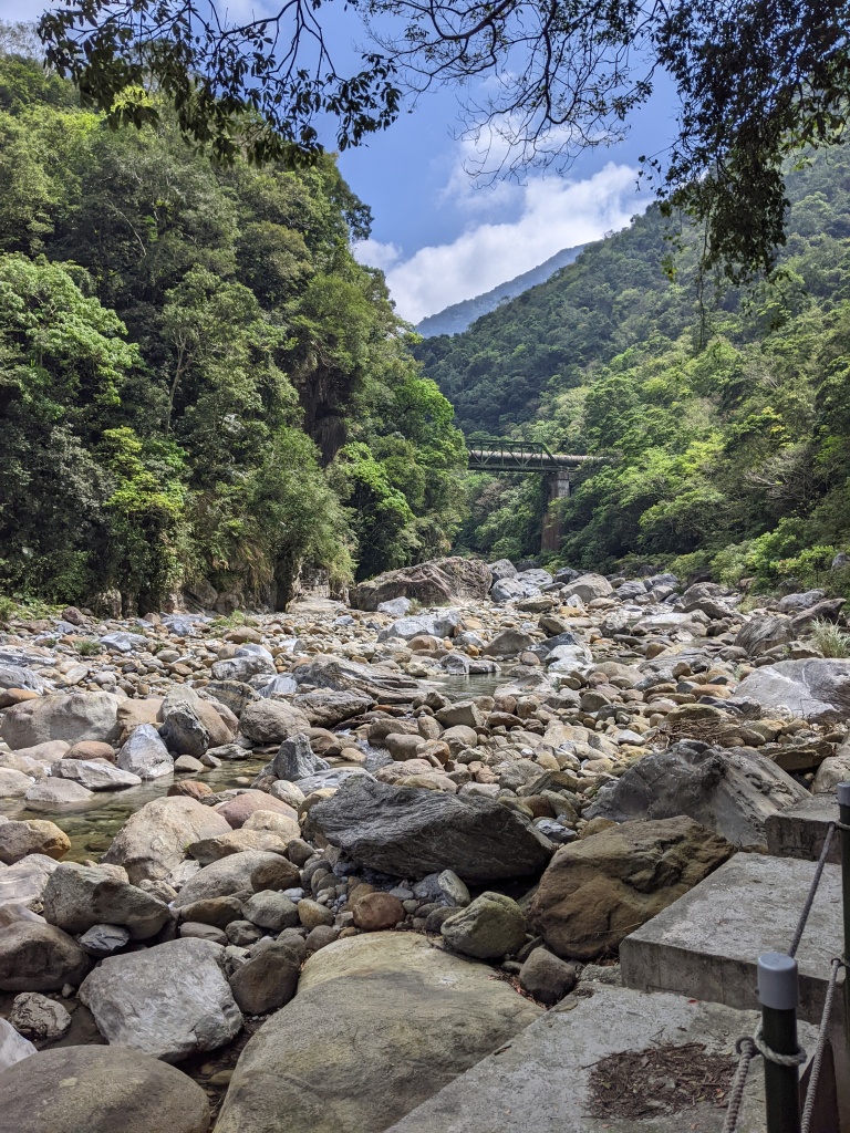
Continuing the adventures of my family and I, when last we left off, we’d taken a 4.5-hour long train ride along the eastern side of Taiwan, starting in Kaohsiung and ending in Hualien. We arrived later in the evening, so we quickly got some food and quietly wandered around the immediate area. Our plan on the morning of April 2nd was to head into Taroko Gorge, the national park that brings tourists into the small eastern city.
The morning began with a spectacular sunrise; our room was on the tenth floor, providing an epic view of the mountains we’d be heading to. Fed and watered, we walked to the train station to meet our tour guide. We booked the tour through Klook, but there are many different services for booking tours; I’ve just found that Klook is generally reliable. Around 8 am, our tour guide, Alicia She 佘藝文, walked into view. I was surprised at how many people were taking the tour since it was a Tuesday morning, but we were a full bus. Mom and sis sat together while I sat beside a lovely man from Norway named Micheal. Our first stop was Qixingtan beach七星潭海岸, which isn’t in Taroko but is on the way. The beach is next to the Hualien airport, which launches F-16s. So, while the scenery of the beach was beautiful, the eardrum-shattering sound of planes launching broke up the tranquility of the ocean scenery.
Matsu is always close by…
After 45 minutes of walking around and pausing to watch the military aerial displays, we loaded back on the bus. We finally were heading into Taroko. Our first stop was the Shakadang 砂卡礑 trail, a gentle river walk in a deep canyon. It was beautiful scenery despite the low water levels. The path was set under the overhang of a rock shelf; at the time, I didn’t think much of the warnings that were posted everywhere on the trail about landslides and rockfalls. We were allotted an hour on the trail, but because it was so gentle, I pushed past the designated ending point and saw some water infrastructure running throughout the park. In my head, I had already begun to plan my backpacking trip in the park, as I really wanted to scale the towering mountains.
After the Shakadang trail, we were loaded back onto the bus and to our next stop, Buluowan 布洛灣 suspension bridge. The bridge and area were developed by the Japanese colonial army, which violently took control of the area in 1914 from the Tailuge 太魯閣 or Taroko indigenous people. The bridge was initially called the Mountain Moon Bridge 山月吊橋; however, the Taiwanese government renamed the area after the indigenous people’s name for the region. The workers in the park and many of the rest stops were Taroko people or Taroko-owned businesses. The bridge is neat; you can walk along the middle and look directly down at the gorge. We also ate lunch in the area since there was a restaurant, and despite being a remote location, the food was tasty.
After lunch, we got back on the bus and were handed hard hats. We would be walking along the Yanzikou 燕子口 trail, literally translated as the Swallow Grotto trail. This road was carved by Chinese military men who’d come over from China with Chiang Kai-Shek. Initially, people were told that the 1949 move would only be for a year, maybe two at the most. Instead, 2 million people ended up in Taiwan, many of them military, with no way back to China. Building a road through Taroko was a massive project undertaken by the government as a way to give retired soldiers work. Many people died during the project, but it was completed in the end. As we walked on the trail above us were carved stone and huge steel rods intended to stabilize the mountain.
Buluowan is the upper bridge
From Yanzikou trail, we headed towards the Tunnel of Nine Turns 九曲洞隧道. The tunnel doesn’t have nine turns, but nine in Chinese is a placeholder number used to mean ‘many’ (like how English speakers use ‘thousands’). The road has since been realigned, so the original path is just for walking. Along the side of the gorge, there is a poem extolling the ability of man to conquer nature. Of course, it was acknowledged later that perhaps this arrogance invited disaster, and the road was ultimately too susceptible to natural disasters, typhoons, earthquakes, etc. The gorge is beautiful, with deep marble canyons and cerulean waters rushing. There’s a plant that grows with minimal sun or soil along the upper parts of the mountain. I really enjoyed the walk deep into the gorge.
Our final stop was the Temple of Eternal Spring 長春祠, which memorializes all the workers who died trying to build the cross highway. The shrine sits in a wash, the Chinese building sitting in stark contrast to the natural landscape. The path up to the shrine was interesting, cut deep into the rock, it was cool and the sounds of water echoed as we walked. I imagine that when flood waters fill the gorge, the mountain, waters, and shrine cast an interesting picture in the valley. I had mixed feelings about the shrine as its history was one of both remembrance and colonization.
We rolled back into the Hualien station around 5 pm. While this wasn’t the hiking tour I thought it would be, I was really pleased with the results. I thought we were going to see the top of a mountain, and instead, I saw a bunch of different places and got to go on some fun walks. If I ever get the opportunity to return to Taroko, I plan to do a backpacking trip to see some views from thousands of feet in the air. We all went to bed with thoughts of heading to Jiaoxi and our hot springs resort.
April 3rd began with little fanfare; we ate breakfast around 6 am and were getting ready to head out for another city exploration before we needed to check out at 11 am. At 7:58 am, the 7.4 earthquake struck while we were on the tenth floor. My initial reaction to the quake was to laugh. Yes, it was shaking, but I’d warned my family that Hualien was seismically active, and I knew we were on the tenth floor so that the shaking would feel worse. I told everyone to wait it out, and the shaking stopped… sort of. The rumbling feeling never left, and there were a few little aftershocks. This went on for a few minutes, and I grew more concerned as I’d never felt this before. Then, the first significant aftershock hit, and I knew something bigger was happening—the big earthquake, despite being a 7.4, only shook from side to side. I’ve probably lived through hundreds of minor earthquakes and a few big shakers, so I am generally unbothered by side-to-side or circular earth movements. The aftershock, which registered as a 6-point-something, felt like the shaking was going up and down rather than side-to-side. It nearly knocked me over, and once I regained my balance, I told my family to evacuate the hotel. I was further backed up by the hotel, which made an announcement over their broadcasting system asking people to head down to the ground floor.
The rest of the day was a bit of a blur. There were earthquakes every 5-30 minutes of varying intensities. All the trains were closed, with workers and railway officials unable to say when the eastern line would open again. Buses weren’t running due to the landslides on the roads. We were effectively stuck in Hualien, which was still shaking. To the credit of Fulbright and my university, both contacted me within 30 minutes of the earthquake, and they continued to check in with me until I left Hualien. My mom and sister were relatively calm despite the boredom of waiting in the hotel lobby while I tried to figure out our next steps. It probably helped that foreign media mainly reported on how quickly Taiwan’s government responded to the crisis, whereas I was reading the Taiwanese news, which reported more on the destruction. I rebooked a room at the hotel since it was obvious that we weren’t going anywhere until the 4th. While trying to figure out how to get home, I probably spent an extra three hundred dollars in American money, a weird side effect of trying to get back to Taipei.
Although we were in Hualien, we weren’t in any real danger. One building collapsed, and the death toll in total is sitting at nine people. The problem is we couldn’t leave, and depending on the damage, we might be stuck for some time. The small number of deaths is really a testament to building codes in Taiwan. Beyond those who died, the fact that Taroko Gorge is indefinitely closed is a loss for Taiwan and the rest of the world. Shakadang trail had a massive landslide, and two people are still missing and presumed dead. Many stories are coming out about the heroes and the efficient, well-coordinated response by the Taiwanese government. If I had to experience the largest earthquake in my life, I am glad it happened in Taiwan, though I could have done without me being in the epicenter.
April 4th was a day of trying to figure out when we could go back to Taipei. As I rolled up into the train station, all the trains were set to run on time, including the trains heading north. Within twenty-four hours, the trains were back on schedule. I grabbed the first three empty seats back to Taipei. It was a three-plus hour journey, but I’d never been so glad to be on a train. As we rolled out of the station, Hualien responded with one more tremor. Along the mountains, evidence of hundreds of landslides and scars of muddy brown against verdant slopes, including one that was very close to the tracks. We made it back to Taipei around 3:30 pm and spent the rest of the day taking some time to gather ourselves.
So, despite the national emergency and the many earthquakes that followed, we made it out safe and sound! The next post will be the conclusion of my family’s trip, where we finished wandering around Taipei and enjoying all the sights and foods Taiwan has to offer. Until next time!
Hello everyone! You will be delighted to know that we all made it back to Taipei safely! Since my mom and sister have returned to the USA, I figured I should give a run down of their trip and probably not this post but next post I can talk about the April 3rd earthquake in greater detail as there are more reports about the damage and the aftermath. But for now, let’s talk family coming to visit Taiwan!
Similar to my partner, my mom and sister rolled in first thing in the morning. I arrived at the airport not minutes before they walked through the airport gates. The goal of the first day was to keep them awake long enough that they could start adjusting to Taipei Standard Time. I took them to visit my place of work, the large mall at Nangang station and the river park by my apartment. I like this for the first day because there’s not pressure to see anything other than were I spend my normal days. I got them checked into the hotel around 3 pm and they went to freshen-up. We made it to dinner and then around 7:00 pm, they decided to go back to the hotel to sleep.
The next day, my mom and sister were still feeling the time change. I took them to the National Palace Museum. I really like this location for the second day in Taipei because it’s a huge air-conditioned building that is full of interesting things to look at and lots of places to sit. There also lovely gardens on the grounds so you can re-acclimate to the outside. I got them both audio guides and unleashed them onto the museum. They spent roughly 5 hours wandering through the different rooms and learning a bit about Chinese history. I bounced between them looking at the new displays and showing off my favorite things. The gift shop at the bottom was a big hit as well. We finished the day with a quick stop to 7-11 for dinner followed by us wandering around the gardens. We got back to their hotel they took a bit of a nap before heading out for dinner. This time they made it 8:00 pm before they were too tired to carry on.
Day three began with rain, and while my mom and sister were feeling more awake, they weren’t quite ready to a rainy hike. So, I loaded them onto the MRT and took them to Chiang Kai-Shek memorial. The grounds are really nice to walk around. CKS, himself, is a complicated figure in history, one that has a bloody, violent legacy. But they spent the next hours learning, first about the KMT’s celebratory history of CKS; and then the long road to democracy and freedom of speech. The two exhibits face one another but are not visible whilst visiting the other. It was an interesting choice of space utilization. Following the exhibitions we went for lunch at Hangzhou Soup Dumplings 杭州小籠湯包, which is across the street from the memorial. This was the first time mom and sis had soup dumplings and they were all devoured. The final time was spent wandering the gardens of the CKS grounds while we let the dumplings and side dishes digest.
This picture looks like LBJ and CKS are on a date…
The next stop was Sun Yat-Sen memorial. Unfortunately, I didn’t realize that main building of the memorial was closed. So while we got to walk around the grounds, there wasn’t much to do. Thus there was only one thing to do, head to the Taipei 101 and enjoy the view. The 101 like every day was crazy busy. It took us almost and hour of waiting in line to go to the observation deck. Once we were there we spent probably 2 or so hours wandering around getting different pictures and just enjoying the spectacular view. We eventually made it back to the ground and grabbed some dinner. We called it a night around 8:30, my family finally on Taipei time.
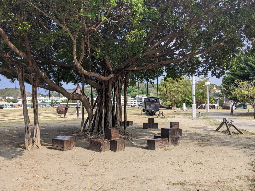
The next day we had plans to travel to Kaohsiung, in the south, but that wasn’t until the mid-afternoon. To kill the time, I took everyone to the Botanical Gardens. My family is from a high Sierra Nevada desert environment, so they were awed by how green and how much was already in bloom for Taipei. The lotus pond in particular was a big hit. After a few hours of wandering, we made a quick souvenir run to the Weekend Jade Market. Mom was very excited to get her trinkets to hand out to everyone back home. I caused a bit of a stir because I was running around translating, but overall it was a fun time. Then we gathered our bags and headed out to Nangang station. We would be taking the high speed rail for a little under two hours. It was delightful to the west side of the country fly by. Around 5 pm we rolled into Kaohsiung station, and after a quick pit stop at the hotel we headed off to the night market. Well-fed and exhausted we headed back to the hotel.
Zoomin’!
The next morning we had some time to kill before we headed to the rail station and up to our next destination, Hualien. We decided to walk around the pier, which had a railroad park, and an art district area. It was fun wandering around and checking out a different city. There was definitely a different vibe to the city compared to Taipei. People were, in general, just a bit more relaxed and there was way more Taiwanese spoken. There were a few moments where people could understand what I was say, but I couldn’t really understand them. One of the neat public transit options was the light rail, which was a street level train that loops around the city. After a minor mix on my part about tickets for Hualien, we found lunch in the station and manged to get ourselves onto the four and half hour train up the east side of the island towards Hualien.
We made it to our hotel with little incident and we were all excited for the tour to Taroko Gorge in morning. Hualien city is a beautiful city, which is punctuated by the F-16s screaming over head, there’s a large military base in the city as well. Fatefully, I’d warned my family that there was a chance of us feeling an earthquake while we were in Hualien, but not to worry too much since they were rarely big. Next post I will continue our adventure on the east side of the island, our trip into Taroko, the earthquake, and our return to Taipei. Until next time!
Hello everyone, this morning (04/03) at 7:58, Taiwan was struck by a 7.2-7.6 magnitude earthquake (the rating is different based on who is reporting it). The epicenter was off the coast of Hualien. My mother and sister are visiting Taiwan, and as part of their trip, I decided to take them to Taroko Gorge, a beautiful national park on the island’s eastern side. We were in Hualien on the tenth floor of our hotel when the earthquake struck. The whole building swayed, but thankfully, nothing in our area fell save for a few building tiles and windows. I’ll admit that while the earthquake was insane in terms of the shaking, I didn’t have my family leave the hotel. I knew the Hualien area regularly has earthquakes, so I figured it was 5+ magnitude and would be an exciting story. That is until the first significant aftershock happened.
When the tremors kept coming, I grew worried, and then, another major quake shook the ground. I had my family evacuate out of the building as quickly as possible. Many people, like us, decided to leave after the second major quake. We piled out onto the street and waited for the shaking to stop. It did, sort of, but even now, as I sit here typing, there are regular aftershocks that we can feel.
The aftermath of all of this is that the trains are totally closed. Buses are running from Hualien to Kaohsiung through Taipei Railways, but it’s unclear whether the trains will open tomorrow or if these buses will be available. There was also major structural damage (bridge and tunnel collapse) along the highway between Hualien and Taipei. So, to get back to Taipei, we will need to go south and then head up the west side of the island. Hopefully, the trains will be back up and running tomorrow, or there will be more buses to take us south so we can get back to Taipei. There is also a major holiday tomorrow, Tomb Sweeping day清明節, which has caused a bunch of problems in trying to get back to Taipei. Mostly the tickets are already bought, so going anywhere tomorrow is really difficult.
The train station was closedWorkers helping people figure out what to doAll trains stopped
In the end, my family and I are safe! We will figure out a road to Taipei, one way or another! Until next time!
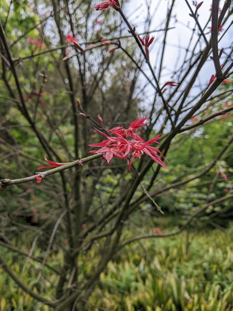
This week’s adventure features the lovely Yangmingshan National Park. In March and April, there are tons of flowers in bloom, so much so that special bus routes run during this time of year to take people to see the fields of flowers. The illustrious Zac and I decided to brave the crowds and head up the mountain to go flower-viewing.
Our day started early, but due to the way public transit works, we weren’t stepping off the bus in Zhuzi hu 竹子湖 (Bamboo Lake) until 9:30 am. We took the flowering bus route 131, which took us to less accessible parts of the park. There is a village in the area with many cafes and restaurants where you can stop. Our first destination was along a canal that took us through Calla lily fields. This was the first hot weekend of the year, with temperatures quickly reaching around 30 degrees (~86 degrees). The day’s goal was to wander around, see some new things, and enjoy ourselves rather than bust out a crazy long hike.
Datun looms!These were all over the parkthe lone cherry blossom
After wandering around the Calla lily area, we walked along a different canal and followed the path through a series of shops and a quick side detour down towards the water, where our first snack of the day was consumed. The next goal then was to head back the way we came to find a viewing platform. On the way to the viewing platform, we detoured into another canal/riverside area, where we were rewarded with a bright red suspension bridge and a functional water wheel. We passed a few people wandering around, but overall, it was a peaceful wander.
Azaleas!
Then, finally, we walked along an unshaded path toward the viewing platform. Despite the lovely walk, the lookout was sadly obscured by the smog. During winter/early spring, there’s a lot of smog coming from Taiwan but also blowing across the strait from China. I hope that by the time summer rolls around, I’ll get clearer shots of Taipei from up the mountains. Zac and I paused for lunch and sunscreen reapplication before winding our way back to Zhuzi hu and our hiking portion of the day. We did make a few detours to view some flowers that we spotted on our way back.
Passing through the now lively market area, we followed the road towards the large mountains to our left. I knew I’d hiked around this area before when I did the second section of the Grand Trail, but I hadn’t entirely oriented myself until we stood at the foot of the stairs, and all my memories flooded back to me. I now had a clear path to Erziping, our next destination. Then, it was a slog upwards through the dense trees. When I’d come this way the first time, it was downhill, but going up, I was pleased to find that the path was taking us up the shoulder of the mountain rather than up the ridge. I also got to bust out my fan from a farmer’s market the day before, keeping the sweat dripping at bay.
Qixingshan looming over us allXiaoyoukeng’s steam rising from the mountain
Once we finished our climb up, rather than heading up the Anbu trail to Datun, we turned off the bamboo-lined trail and took the short walk to the Erziping Visitor Center. We took a moment to readjust and sunscreen up once more before taking the easy route towards a very familiar area. It was sunny, but getting later in the day, a breeze passed through the trees, and the clouds were rolling through the mountain tops. Erziping was beautiful, and for the first time, I was able to catch Miantian’s reflection in the pond. The air was filled with the sound of frogs, and butterflies danced around the blooming foliage.
Easiest hike in the park and very rewarding!
The rest of the way was the familiar path from Erziping to Qingtian Temple, but I was descending out of, rather than climbing into, Yangmingshan. It’s always great to reverse directions on a familiar path and see new things when you do. The view was slightly better, and we finished the last 3 km out of the national park; Guanyin Shan was visible from across the Danshui River. Despite being on our feet for most of the day, we finished the hike in good spirits and with enough time to change our shirts so we didn’t stink up the bus too badly. The s6/小6 bus came ten minutes after our arrival, taking us back to Beitou MRT station.
Zac approved hiking!Big ol’ Banyan tree
I really enjoyed seeing familiar routes but in different seasons. I will say hiking out of the park was probably our best option; around the park bus stations there were so many people trying to use the small buses that people were waiting more than two hours to get out. I have family coming to visit soon, so the next updates should be on their exciting adventures! Until next time!
The weather has been stormy and cold in recent days, but there was a small break in the storms. I decided to head out for a hike on the northwestern side of New Taipei City 新北. I’ve hiked a portion of the Taipei Skyline trail, particularly the northern portions, so hopping over to the western trails, so I got a different view. The journey started at Huilong MRT station, and I hiked to Yingge train station. This constituted most of section 8, but I cut off the large city walking portion, mostly because I have a friend I was meeting for coffee later in the day.
The hike begins about a kilometer from the train station at a memorial for soldiers from New Taipei City. The alleyway provided an interesting grey-and-white contrast as I approached the stairs. This area also has an aviation park and several other military attractions, but I decided to head on rather than stop. The trail was paved with crumbling concrete and random metal bars to protect hikers from the sharp edges. This was the steepest part of the day, climbing roughly 200 meters in less than a mile. I reached the top, and on a clear day, it probably would have been a nice view, but instead, it was obscured by clouds. I also nearly ran into a giant spiderweb, suggesting that this path wasn’t traversed too often.
No mess, only a hillsideThe “view”Not TSLT signage but it worked
The path continued southward along a utility road. I’m unsure if I went the right way, but I found myself on a hilltop with a huge transistor and electrical tower. I then made a quick descent and found myself on the road. There was a pack of dogs roaming around that initially ignored me but got worked up when a motorist came up. Thankfully, they just barked at me, but it was a little nerve-wracking. I had looked at the route before setting out, but I didn’t expect to be on the road for as long as I was. I even passed through a small mountain town where more dogs were roaming. I will say this was the first time I was on a trail that linked up with a popular cycling route, so lots of Cannon bikes and Lycra to witness. Eventually, there was a turn-off from the mountain road and back onto a hiking trail.
This part of the hike was lovely. The overcast sky made the greens of the plants and trees pop. It was a natural path that made it ten times better. I was heartened that this area seemed more populated than the previous one. It was a slow, winding path up to the top with exciting features along the way. Namely, there were suddenly many people on the trail right before the summit. One gentleman told me I was in for a beautiful view at the top. And he was right; there was an inversion. So all the clouds were sitting over the city, hiding it from view, but the mountains surrounding Taipei and New Taipei were poking out. It was a unique view.
After dodging all the cyclists, including one that remembered seeing me hiking and was impressed at how fast I was able to walk, I found myself once again on mountain roads. But unlike some mountain roads, this was traversed enough by people, and there was a clearly defined shoulder and even some landscaping. There were also a plethora of roadside temples, which was interesting as mountain roads usually don’t have much other than a destination. Around 11:45 (I’d started hiking at 8:30 am), I found myself and a nice lookout area called the 100-year-old Banyan Tree, where a bunch of people was eating lunch. I joined them, the unusual hiker, as I got the sense most people had given up and were hiking the small hill rather than the long path I was taking.
The view when there aren’t clouds
Lunch consumed, I turned eastward, heading back towards the city. After an hour or so of road walking, I was grateful to be on an unpaved path again. There were some very steep sections and a few sections where I wasn’t sure of the path’s direction, but the signage and number of hikers made it easy to stay on the trail. I passed by the Guanyin/Buddhist shrine on top of a large rock, which is an interesting little nook of the mountains. I then turned towards the last major site of the day, Yingge Rock.
The trail at this point was brimming with hikers, many of whom were far more casual, so I would see street shoes and nice dress pants traipsing through the mountains. I always get an odd look since I am usually sweaty and have a big backpack. It’s hard to explain I’ve been hiking for the last four hours. I eventually found myself descending on Yingge rock, where many people were taking pictures of the area. I left relatively quickly as besides the rock, there wasn’t much to see. As I descended the stairs, a gentleman resting at a pavilion with his wife asked me: 多遠 or how far? But my hiking-addled brain thought he was asking me how far I’d come. So I told him I’d started in Huilong. Which caused confusion, and we just stared at one another. His wife dismissed me as a foreigner, making me double down on trying to figure out what he was asking. Somehow, I’d forgotten I’d just passed the most famous attraction in the area (it really didn’t leave much of an impression on me), and once he said Yingge Rock, I told him he had less than a minute of hiking left. Overall, a puzzling encounter.
But once I descended the stairs, I only needed to get to the railway station. The area was nice, with temples and convenience stores lining the road. The train was only half a mile from the bottom of the trail entrance, so I was on the platform and headed back to Taipei in no time at all. I love the train system in Taiwan; it is so convenient.
Overall, there were portions of this hike I would do again and portions of it that I will never revisit. I want to go again on a clear day and get some of the promised views of this hike. But that’s another section of the TSLT, done and dusted. Hopefully, as the weather gets nicer, I’ll get more new hikes completed. Until next time!
Hello everyone! It’s been a little while; apologies for the radio silence. I’ve been busy writing and working on some Ph.D. requirements, the Fulbright grant, and ensuring everything is set up for when I return home in July. I am back now and hopefully can keep posting once a week. Today is a hiking adventure! I did the very first part of this trail back in November but turned off after the first 20 or so minutes to follow the Caoling old path 草嶺古道. I followed the Taoyuan Valley signage along the ridgeline instead of turning toward Fulong Beach.
My planning for this trip was a bit spur of the moment. I’d thought to go north, but the weather meant that the path I wanted to hike was enveloped in the clouds. Thus, I made a last-minute decision: I headed to Yilan County. I ended up needing to wait a while for the train and do a transfer at Ruifang. Once on the local train out of Ruifang, I was the only person in the car, which was a novel experience for me. I was deep into a podcast when the train stopped at my destination– Dali.
The first time I’d gone to the Dali train station, it was overflowing with people. This time, perhaps due to the overcast and cold day, it was nearly deserted. I walked the peaceful path from the train station to the trailhead, where I was confronted with a delightful English sign. The Chinese are warning about an Asian hornet attack, which can happen and be deadly, but somewhere, the auto-translate decided that ‘hornet attack’ was ‘attacked vespa.’ After that amusing moment, I was on my way up the mountain. It was easy to get to the first landing, where the path splits between the Caoling route and the Taoyuan Valley. So up I went, towards the ridge line.
Due to the hike’s popularity, the path is well maintained and essentially is 7 miles of stairs. Tops of mountains had small pavilions to peel off, enjoy the ocean view, and snack. I passed a few people along the way, but I was mostly by myself for the first section. I’ve gotten accustomed to climbing stairs for hours and find it easy to drop into a pattern of thinking and moving. Eventually, I crested the first major mountain and caught up with a few sets of hikers going my way. Little cit chats along the path passed the time as we followed the up and down of the ridge line.
After the first area, the next area was water buffalo territory. I’d seen evidence of them all along the trail, but I didn’t spot a single one in the first hour. Then suddenly, there was a herd. They were scattered along the hillside, seemingly unbothered. I took a few pictures but didn’t want to linger too long in case the calves or cows got too nervous and decided to move me along. One exciting moment was when a calf suddenly started lowing loudly and running towards the path. Everyone stopped trying to figure out what was going on. At first, I thought it was charging one of the hikers, but it turned out its mother was up the mountain, and it’d spotted her. The baby ran to the mother, and they were reunited. All the hikers, myself included, just stared momentarily, taking photos. I then pressed on.
Warning people about the water buffaloThe calf and momThe onlookersFulong in the background
I reached the highest point a little after noon, 616 meters (~2,021 ft). The view was spectacular, but the wind was blowing cold. People were stopped around, sitting on the steps or benches, eating lunch. I had my apple slices and a riceball but moved on quickly. There was a steep decline in elevation as the net part of the trail opened up. I had a weird encounter with a group of hikers. This gentleman tried to talk to me but used an odd mix of English, Taiwanese, and Mandarin. I felt terrible, but I couldn’t understand him at all. I was more able to talk to his friends who spoke in Mandarin with me. He was frustrated, but I extricated myself quickly with a compliment on his English ability and a quick goodbye. The following person I encountered spoke in Taiwanese, but the conversation was much more fun as he knew I wouldn’t understand him but tried to greet me anyway.
Within the next hour, I found myself at the halfway point of the hike: the actual Taoyuan Valley. The stairs faded away, and I was on a glorious natural path. The valley wasn’t anything interesting, just a large area on top of the mountain. Due to the winds that come off the ocean, the ridges appear bald, with little vegetation save for some grass. After I passed through the halfway point, the landscape changed. Gone were the empty grass ridges, and trees appeared. I’d moved out of the wind’s path, so the ridgeline supported a different ecosystem. The path was slowly heading down, and then there was a T-junction with the left taking me down towards Daxi.
The descent down to Daxi was surprisingly long. The ridgeline I’d been following had naturally led inland, and I needed to return to the ocean. So I ended up crossing three or so summits, so not the nice, easy descent that I typically get at the end of the hike. Again, I was fascinated with how the ecosystem changed as I changed elevations. It went from mountain shrubs to dense forest, and then, when I reached the bottom, I saw salt-tolerant plants. I made it down around 2:45 in the afternoon and began to make my way to the train station. Tragically, I arrived as the train was pulling away from the station, and due to the remote nature of the train station, I had to wait an hour to get the next train. Thankfully, it was a relatively deserted train station, so I used the time to stretch and finish up on my podcasts.
Weather station
The ride home was long, but I made it back in one piece. I showered and stopped by my usual curry place. I keep hoping that the weather will improve and that the sun will come back to Taiwan. But in the meantime, there are cloudy hikes and rainy mornings. Until next time!
Hello friends and family! I am currently working on a few things with rapidly approaching deadlines, so the posts for the next month or so might be short, or they may only happen once a week. I might try to include a few academic updates and maybe try to give you a day in the life of a Taiwan Fulbright research fellow. I am still hiking regularly, but due to weather and time constraints, I’ve stayed close to home on trails you’ve seen before, so there is nothing new to report! Hopefully, I’ll be back out on the trail soon.
What I have for you today is an adventure Zac and I undertook as a right of passage – the Taipei Lantern Festival. The lantern displays ran from Ximen MRT station to Beimen MRT station. I call it a right of passage because our walk from station to station was a people mountain, people sea 人山人海, a four-character saying implying that there are tons of people everywhere.
Our adventure began with the auspicious start of being unable to find a seat at any restaurant or, in one case, being turned away because the restaurant was entirely out of food. After wandering around hungry, we opted for the classic Taiwanese meal of the convenience store variety, specifically Family Mart. I don’t usually advocate for convenience store food as an option, but navigating the crowds hungry would not have been wise.
Fed and watered Zac and I began to walk through the light displays. The initial displays were all dragon-themed. The route also forced us to cross the street, which involved two lights and a clash of human bodies trying to go in opposite directions. We made it and began to wander down the tunnel of lights, one of which was a lovely homage to the history of Ximen, a place of protests, art, and change.
So many people…Fish-theme light tunnel is approved! Masks were a must for the amount of people we were wading through
The swimming with the people continued as we made our through different lantern displays. This festival marks the first full moon of the Lunar New Year and the end of the Spring Festival. There are many different traditions and stories connected with the Lantern Festival, but the one I like is that the Jade Emperor 玉帝 (a Daoist deity who heads the heavenly bureaucracy) planned to have a village destroyed because they ate his goose. A sprite warned the townspeople and advised them to light lanterns throughout the town. The Emperor saw the light from the lanterns, thought the city was already on fire, and did not attack. Thus, people started to light lanterns every year to celebrate survival.
Besides the themed displays that we wandered through, there were also just tunnels of light a street lit up by string lights. People were playing the game of trying to take photos in the street while avoiding the cars that were trying to use the street. Why anyone would drive in that area while the lantern displays are out is a mystery. I also appercaited the fact that the term latern was less of phsycially grounded object, and more just anything that had the capacity to light up. At the end of the street with lights there was a small gala performance where people were singing old-fashioned songs and generally having a good time.
The final part of the displays was interesting as they seemed to be sponsored displays. So there were company names all over them. There was also an entire row of displays that had Japanese prefectures and monuments that I found interesting. Japan and Taiwan have a complicated relationship as the Japanese Empire colonized Taiwan for 50 years, from 1895 to 1945. However, despite the violence during the colonial period, Taiwan and Japan have a good, diplomatic relationship. Some of these, in my humble opinion, have to do with American influence and that the Kuomintang government was just as violent and brutal as Japan when they took control of the island in 1945. If you want to learn more about history, I recommend the Formosa Files podcast. All that said, the lantern displays were fun to look at, geopolitics notwithstanding.
西 means west and is in the name if the area Ximen or west gateAnd just for flavor, a Shanghai display
Zac and I emerged on the other side after spending a good few hours deep in the crowds. The final display was a huge red lantern that stood like an effigy before the Beimen MRT entrance. The walking around had made us hungry again, so we resolved to pop into Raohe night market before heading back to our respective apartments. One bag of fried chicken later, we passed one of the local temples, which had its own small lantern display, so Zac and I popped in. It was a nice way to end the night.
Red Lantern or the Eye of Sauron…Mmm, deep-fried goodnessLocal displayDragon made of lanterns
It was an entertaining evening, though probably not my favorite lantern display I’ve been to. I feel like outside the city, where there is more room to go full out and build a light village, is probably a better display. Also, while the crowds were part of the experience, I always prefer a quieter evening and not constantly having to mind where I step or where my friends are. Happy Lantern Festival, everyone! Until next time!